
Hike to La Concha Peak (Map & Instructions)
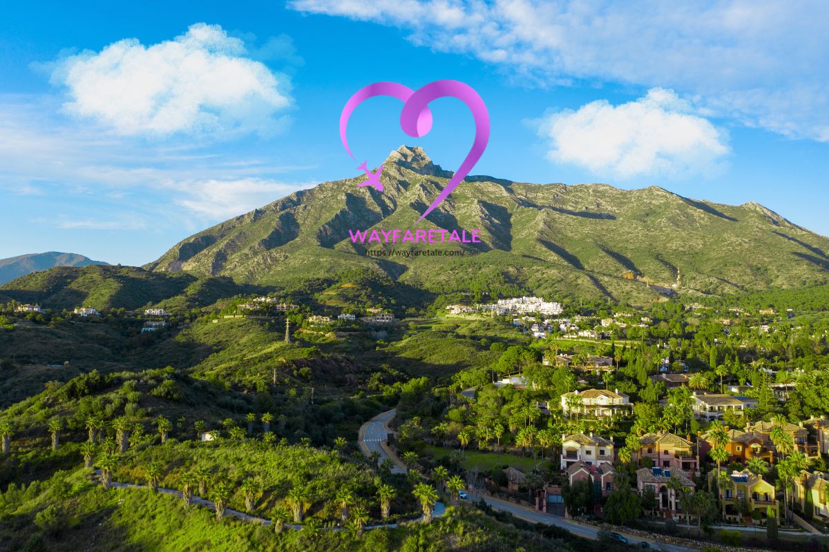
This spectacular hike takes you to the summit of La Concha, the iconic triangular peak that towers over Marbella and the Costa del Sol. It’s a challenging but rewarding day in the Sierra Blanca mountains with breathtaking views.
La Concha, which means “The Shell” in Spanish, rises 1,215 meters above sea level and serves as the dramatic backdrop to Marbella’s beaches. The peak is known locally as the queen and protector of the town, and it’s one of the most popular hiking destinations in southern Spain.
This excellent there-and-back hike winds through fragrant pine forests, traverses rocky ridgelines, and scrambles along narrow paths with chains to aid your ascent. The views throughout are magnificent, stretching from the Mediterranean Sea to the mountains of Morocco.
The walk is graded medium to challenging. You’ll need to navigate rocky terrain, handle some light scrambling with chain-aided sections, and have a decent level of fitness for the 6-7 hour round trip.
In this blog post, I’ve covered everything you need to know about the La Concha hike, including how to get to the trailhead, a detailed map, and step-by-step instructions for reaching the summit.
LA CONCHA HIKE OVERVIEW
- Start / Finish: Refugio de Juanar
- Distance: 13 km / 8.1 miles (round trip)
- Duration: 6 hours 30 minutes (including breaks)
- Elevation gain: 900 meters
- Difficulty: Medium to Challenging
- Trail: PR-A-168
I don’t usually love there-and-back hikes, but the dramatic scenery and incredible summit views make this one absolutely worth it.
The hike begins at Refugio de Juanar, a former state-run hotel nestled in the mountains above Marbella. The trail follows the PR-A-168 route through shaded pine forests before emerging onto exposed ridgelines.
After about an hour, you’ll reach Puerto Las Allanas on the ridge, where the real adventure begins. The path winds along narrow ridges, traverses beneath the imposing rock face of Salto del Lobo (Leap of the Wolf), and scrambles over rocky terrain to reach the summit.
I’ve rated this hike as medium to challenging for three reasons.
Firstly, the total distance and elevation gain of 900 meters can be tough on both your lungs going up and your knees coming down.
Secondly, the terrain is extremely rocky throughout. You’ll be stepping over boulders and watching your footing for most of the hike, which becomes tiring after several hours.
Thirdly, the path along the ridgeline can be indistinct in places and requires concentration to follow the markers. There are exposed sections with steep drops, including one narrow ledge where you’ll use a chain for support.
It took me 3 hours 20 minutes to ascend and 2 hours 40 minutes to descend. In total, I spent about 6 hours 30 minutes, including a 30-minute lunch break at the summit to soak in the incredible views.
LA CONCHA HIKE MAP
Below is a map of the La Concha hike showing the PR-A-168 route from Refugio de Juanar to the summit (marked in red).
The starting point at Refugio de Juanar is marked in brown, with the car park location clearly indicated.
For those who prefer physical maps, I recommend: Kompass 1:50,000 – Sierra de las Nieves.
For digital navigation, download the Andalucía region on Maps.me. It has all the trails marked, and you can track yourself offline. The app is invaluable for following this route, as the path can be indistinct in places.
USING OUR MAPS: Click on the top right corner to open in the Google Maps app. Click on the star to save to your Google account.
GETTING TO THE TRAILHEAD
The La Concha hike starts at Refugio de Juanar, located at the end of a mountain road north of Marbella. This former Parador (state-run hotel) sits at an elevation that gives you a head start on the climb.
BY CAR
Refugio de Juanar is a 25-minute drive from Marbella town center, 45 minutes from Málaga, and about 1 hour from Estepona.
From Marbella, head inland following signs to Ojén. After passing through Ojén, continue for approximately 11 kilometers on the winding mountain road. You’ll see the Refugio de Juanar signposted on your right.
The last 5 kilometers are along a narrow but well-paved road that twists as it climbs. When I last drove it, a few rocks had fallen onto the road, so drive carefully and watch for debris.
Parking: Free parking is available along a gravel road on your left just before you reach the Refugio. This parking area stretches for about 300 meters. The further up you drive, the shorter your walk will be, but the road becomes increasingly rough with large ruts.
I parked near the beginning of the gravel road to avoid the worst sections. On weekends and during peak season, parking fills up quickly, so arrive early. Some hikers have reported having to park 5 kilometers down the road when arriving late, which adds 4 hours to the total hike time.
BY BUS
Public transport to Refugio de Juanar is extremely limited. The nearest bus stop is in Ojén, from where you’d need to walk or taxi the remaining 11 kilometers uphill. I highly recommend driving or arranging private transport for this hike.
HIKING INSTRUCTIONS
REFUGIO DE JUANAR TO PUERTO LAS ALLANAS (1 hour 10 minutes)
I left my car at the parking area and headed up the gravel road past the remaining parking spaces. The trail begins by passing through the side of a metal gate.
From here, the wide track climbs gradually under a lovely canopy of Aleppo pine trees. I kept to the right, following the signs for “La Concha” and ignoring the signs to Mirador del Corzo on the left.
The morning sun filtered through the pines as the sweet scent of pine resin filled the air. After about 15 minutes, the pines gave way to beautiful wildflowers and eucalyptus trees lining the trail.
Twenty minutes after leaving the car, I reached a significant split in the trail (this is marker 1 on most maps).
I turned right, following the PR-A-168 sign to La Concha. The left path leads to Mirador del Macho-Montes and Cruz de Juanar, which is an optional detour I’ll describe later.
The path makes two sides of a triangle around a small stone outhouse, passes a line of gnarled olive trees, and heads deep into the pine forest. The shade was welcome as the temperature began to rise.
After a few minutes, I arrived at another junction and turned left, following the sign to La Concha. The sign optimistically indicated 2 hours to the summit, but I found this to be quite unrealistic.
The wide trail gently meandered through the forest for about 20 minutes before leaving the shade. Here, the path narrowed and began to climb in earnest.
The rocky track became increasingly sandy and steep. I was grateful for my hiking poles as I negotiated the loose surface. Just over an hour after leaving the car, I reached the ridgeline at Puerto Las Allanas.
This is a significant milestone. The views suddenly open up, and you can see the Mediterranean Sea glittering below and the challenging ridge ahead.
PUERTO LAS ALLANAS TO PICO DEL LASTONAR (1 hour)
I turned right at the junction of paths at Puerto Las Allanas and was relieved to find the path temporarily flattened out. Fragrant rosemary and colorful wildflowers lined the trail, and glimpses of Marbella and the azure sea appeared through gaps in the trees.
After 5 minutes, the path split again. I took the left-hand fork signed “Juanar La Concha (3.3km).” This section was delightful, with easier terrain and spectacular coastal views.
The trail steadily climbed before reaching a large cairn. Keeping right at the cairn, I immediately arrived at a wooden pole marking Puerto Los Tres Pinos.
I turned left at the pole and descended on a rocky path. After a sharp left turn, the trail began one of the most dramatic sections of the entire hike.
The path traverses beneath the huge rocky face of Salto del Lobo (Leap of the Wolf). It’s an exhilarating section where the trail clings to the edge of the rock face. At times, there’s a steep drop on your right, but the views are absolutely spectacular.
There’s one tricky section where the ledge narrows to about 50 centimeters wide. A sturdy chain is anchored to the rock here, providing support as you take two or three careful steps across. While this section might look intimidating, the chain is well-secured, and most hikers manage it without difficulty. Just take your time and don’t rush.
At the end of the traverse, the path climbed back up to the ridge, and Pico del Lastonar appeared ahead. The summit of La Concha was now visible in the distance, looking both close and impossibly far away.
I followed the path as it contoured to the left of the Lastonar summit. The route became indistinct here, so I kept my eyes peeled for small cairns and white-and-yellow paint marks on the rocks.
These markers are crucial for staying on track. I strayed off the path twice and found myself on increasingly difficult terrain before backtracking to find the proper route.
Before long, I reached a large cairn on a narrow ridge, marking the start of the final push to La Concha.
CAMINO DEL LOBO TO LA CONCHA SUMMIT (1 hour 10 minutes)
All that remained was hiking along the narrow ridge known as Camino del Lobo (Path of the Wolf) to the summit. However, this final section proved to be the most challenging.
The ground is extremely uneven, with loose rocks and boulders everywhere. The path alternates between following the top of the ridge and trails running just below the peak on either side.
There are various route options, and finding the easiest path isn’t always obvious. I kept my eyes glued to the terrain ahead, looking for wooden poles, stone cairns, and yellow-and-white paint markings on the rocks.
Whichever route you take will involve some light scrambling, but the trail is exciting, and the views are absolutely magnificent. The Mediterranean stretches endlessly to the south, while jagged peaks surround you on all sides.
From the large cairn, a rocky outcrop blocked the route along the top of the ridge. To navigate around it, I circumnavigated to the right following a wooden pole marked with yellow and white stripes.
I turned right at the pole and headed slightly downhill to another marker, then turned left and climbed back up to find myself on the other side of the outcrop.
The path continued across bare rock to another sign giving me a choice: head along the exposed top of the ridge or take a path that skirts the summit to the right.
The ridgetop looked rather airy and exposed, so I chose the right-hand path. This took me downhill slightly and then along a trail below the summit ridge. The two routes eventually meet up and pass to the left of the ridgetop before regaining the apex.
Shortly before reaching the summit, I took a path off to the right rather than continuing along the tricky ridgetop. This was much easier and brought me to the summit from the side.
I reached the wooden summit cross of La Concha just over 3 hours after leaving the car, exhausted but exhilarated.
LA CONCHA SUMMIT
Standing at 1,215 meters, the summit of La Concha offers some of the most spectacular views in Andalucía.
To the south, Marbella sprawls along the coast with the deep blue Mediterranean beyond. To the west, the village of Istán nestles beside the Embalse de la Concepción reservoir. To the east and north, craggy mountains and rocky facades stretch as far as the eye can see.
On a clear day, the Rock of Gibraltar rises dramatically from the sea to the southwest, and if you’re lucky, you can see the Atlas Mountains of Morocco shimmering on the horizon across the Strait.
I’ve completed this hike twice—once in glorious sunshine and once in intermittent cloud. Both experiences were incredible, but the clear-day views are truly unforgettable.
There’s a wooden bench at the summit where I sat to eat my lunch, rest my weary feet, and soak in the 360-degree panorama. I spent about 30 minutes at the top, not wanting to leave this magical place.
The descent took me 2 hours and 40 minutes, and I was grateful to be heading downhill. The entire hike took 6 hours and 30 minutes from start to finish.
At the end, I walked past my car and up to the Refugio de Juanar for a well-deserved cold beer on their lovely outdoor terrace. It was the perfect way to celebrate a magnificent day in the mountains.
REFUGIO DE JUANAR
The Refugio de Juanar at the trailhead is a wonderful place to celebrate the end of your hike or prepare before you begin.
This former Parador has been converted into the Hotel El Refugio de Juanar. It offers excellent facilities including a restaurant, bar, and outdoor terrace with beautiful mountain views.
The restaurant serves traditional Andalusian cuisine, and the bar serves cold drinks—essential after a hot day on the trail. Even if you’re not staying overnight, you’re welcome to stop for refreshments.
The outdoor terrace is particularly lovely in the late afternoon, with tables scattered among the trees and views across the valley. I highly recommend ending your hike here with a drink while your legs recover.
If you want to split the hike over two days or simply enjoy a mountain retreat, you can book a room at the hotel. It’s a peaceful location with no other buildings nearby, making it perfect for a quiet getaway.
OPTIONAL ROUTE VIA CRUZ DE JUANAR
For those wanting an extra challenge, you can extend the hike by including the summit of Cruz de Juanar (1,189m) on your way to La Concha.
At the first trail junction (marker 1, about 20 minutes from the car), instead of following PR-A-168 directly to La Concha, follow the sign to Mirador del Macho Montes.
This path leads to a fantastic viewpoint overlooking Marbella and the coast. From the mirador, you’ll retrace your steps slightly and then turn left to follow signs for Cruz de Juanar.
The path splits again almost immediately—take the right fork and climb steeply up the zigzag trail. As you approach the summit, the path becomes increasingly rocky and requires some scrambling over boulders.
A metal cross marks the summit of Cruz de Juanar, which provides stunning wide-ranging views of the Costa del Sol and the Mediterranean.
The path then drops down the other side and rejoins the PR-A-168 at Puerto Las Allanas, where you continue toward La Concha as described above.
This detour adds approximately 30 minutes and roughly 150 meters of additional ascent and descent to the hike. It’s excellent for those seeking extra challenge and different perspectives, though you don’t miss essential scenery if you decide to skip it.
BEST TIME TO HIKE LA CONCHA
The best time to hike La Concha is from March to June and September to November. During these periods, temperatures are moderate, the weather is generally stable, and the trail isn’t too crowded.
Spring (March-June): This is my favorite time to hike La Concha. The temperatures are pleasant, wildflowers bloom along the trail (especially in May and June), and the air is crystal clear. Morning temperatures start cool and warm up by midday.
Summer (July-August): Summer can be extremely hot, with temperatures exceeding 35°C (95°F). If you hike in summer, start very early—ideally at sunrise—to complete the exposed sections before the heat becomes oppressive. Bring extra water and sun protection.
Fall (September-November): Autumn offers excellent hiking conditions with cooler temperatures and usually clear skies. September can still be warm, but October and November are perfect.
Winter (December-February): Winter hiking is possible on clear days, but the summit can be cold and windy. Snow occasionally covers the upper sections, making the hike more dangerous. Check weather conditions carefully before attempting a winter ascent.
I hiked in mid-May in near-perfect conditions. The trail was moderately busy up to Puerto Las Allanas, but far fewer people continued to the summit. Arrive early on weekends to secure parking and avoid crowds on the trail.
Weather Warning: Mountain weather can change rapidly. Even on days that start sunny, clouds can roll in quickly, bringing wind and reducing visibility. Always check the weather forecast before you go, and be prepared to turn back if conditions deteriorate.
WHAT TO TAKE ON THE HIKE

Hiking Boots: The terrain is extremely rocky throughout, so I strongly recommend proper hiking boots with ankle support and good grip. While I’ve done it in trail running shoes, boots provide much better stability and protection.
Hiking Poles: I’m a complete convert to hiking poles after this hike. They’re invaluable for stability on the rocky descents and provide extra support on the scrambling sections. I use Leki trekking poles, which have served me well on countless hikes.
Water: This is crucial. Bring at least 2 liters per person, more in summer. There are no water sources on the route, and you’ll be surprised how much you drink. I use a hydration pack, which makes it easy to drink regularly without stopping.
Sun Protection: Once you leave the pine forest, there’s virtually no shade. Bring high-SPF sunblock, a wide-brimmed hat, and sunglasses. The sun reflects off the pale rocks, increasing exposure.
Layers: Even on warm days, bring a light jacket. The summit can be windy and surprisingly cool. I also recommend a lightweight rain jacket, as afternoon thunderstorms can develop quickly in the mountains.
Food: Pack substantial snacks and lunch. The summit is the perfect place for a picnic, and you’ll need the energy for the return journey. I brought sandwiches, fruit, nuts, and energy bars.
First Aid Kit: Bring a basic first aid kit with plasters, bandages, and pain relief. The rocky terrain increases the risk of twisted ankles or minor cuts.
Navigation: While the trail is marked, the route can be confusing, especially along the ridge. I recommend downloading the route on Maps.me or Kompass, which work offline. A physical map is also useful as a backup.
Phone/Camera: The views are spectacular throughout, so bring a fully charged phone or camera. There’s intermittent mobile signal at the summit, useful in emergencies.
Headlamp: If you’re hiking in winter or start late, bring a headlamp in case you’re descending in darkness.
IMPORTANT SAFETY INFORMATION
Fitness Level: Don’t underestimate this hike. While it’s not technically difficult, the distance, elevation gain, rocky terrain, and exposure mean you need good fitness and hiking experience.
Navigation Skills: The route requires constant attention, especially on the ridge. The path isn’t always obvious, and it’s easy to stray onto more difficult terrain. Pay close attention to markers.
Fear of Heights: If you’re uncomfortable with exposure, the traverse below Salto del Lobo and the ridge walk might be challenging. While the chain-aided section is secure, there are drops on one side.
Emergency Services: There are no facilities on the route and limited mobile signal. In case of emergency, dial 112 (Spain’s emergency number). Make sure someone knows your hiking plan.
Weather Awareness: Check the forecast before you go. If storms are predicted, postpone your hike. Lightning on exposed ridges is extremely dangerous.
Turning Back: There’s no shame in turning back if you’re tired, the weather deteriorates, or you’re running low on daylight. The mountain will be here for another attempt.
WHERE TO STAY
The most unique place to stay is the Hotel El Refugio de Juanar at the trailhead itself. This former Parador offers comfortable rooms, a restaurant, and stunning mountain views. It’s ideal if you want to start hiking at dawn or enjoy complete tranquility. There’s nothing else nearby for miles, making it a perfect rural retreat.
Marbella (25 minutes away) is the most popular base. It offers every type of accommodation from luxury hotels to budget apartments, plus excellent restaurants, a charming old town, and beautiful beaches for relaxing after your hike.
Ojén (15 minutes away) is a traditional white village that’s quieter than Marbella but still convenient. It has several small hotels and restaurants with authentic Andalusían charm.
Istán (20 minutes away) is another pretty white village option, known for its waterfalls and traditional atmosphere.
I stayed in Marbella, which gave me the perfect combination of mountain hiking and beach relaxation. After conquering La Concha, lounging on Marbella’s beaches felt like the ultimate reward.
FINAL THOUGHTS
The hike to La Concha summit is one of the best mountain hikes in Andalucía. It’s challenging enough to feel like a real achievement but accessible enough for fit hikers without mountaineering experience.
The diversity of terrain—from shaded pine forests to exposed ridges to rocky scrambles—keeps the hike interesting throughout. The views are absolutely spectacular, especially from the summit where you can see the Mediterranean, Gibraltar, and on clear days, Morocco.
This hike gave me a completely different perspective on the Costa del Sol. Instead of beaches and resorts, I experienced the wild, rugged mountains that form the dramatic backdrop to the coast.
If you’re visiting Marbella or the Costa del Sol and enjoy hiking, don’t miss La Concha. It’s a challenging adventure that rewards you with some of the finest views in southern Spain.
Just remember to start early, bring plenty of water, wear proper footwear, and take your time navigating the ridgeline. And definitely celebrate at Refugio de Juanar afterward—you’ll have earned it!
Have you hiked La Concha? I’d love to hear about your experience in the comments below. Safe travels and happy hiking!