

How To Hike to Refugio Fratelli Fonda Savio (Map & Instructions)
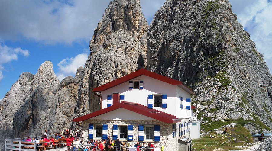
This excellent hike takes you to Refugio Fratelli Fonda Savio in the heart of the soaring pinnacles and scree fields of the Cadini di Misurina. It’s a dramatic and spectacular day in the Sesto Dolomites.
The Cadini di Misurina are a group of spiky mountains in the Sesto Dolomites, featuring near-vertical rocky facades that are almost only accessible to climbers or via ferrata enthusiasts. But this hike is easy to follow (though strenuous) and allows you to witness this dramatic landscape without climbing gear.
Refugio Fratelli Fonda Savio sits majestically at 2,367 meters above a scree-filled basin, surrounded by an amphitheatre of towering peaks. On a fine day, the outside terrace is filled with climbers taking a break from attempting the pinnacles that surround the hut. On a cloudy day, it’s a brooding, moody place drifting in and out of the mist.
This excellent there-and-back hike steadily ascends through larch forests, traverses a dramatic rocky basin, and scrambles up a short scree slope to reach the wonderfully remote rifugio.
The views, especially in the second half, are spectacular. You’ll find yourself in Ciadin dei Tocci, surrounded by an amphitheatre of soaring peaks including Torre Wundt, Torre del Diavolo, and countless other pinnacles that pierce the sky.
The rifugio itself is one of the most dramatically situated mountain huts I’ve encountered in the Dolomites. It’s a perfect place to stop for a hearty bowl of spaghetti Bolognese and soak in the wild alpine atmosphere before making your way back down.
The walk is graded medium. You’ll need a decent level of fitness to handle the 550 meters of elevation gain, and while the trail is well-maintained, there are rocky and loose scree sections that require careful footing.
In this blog post, I’ve covered everything you need to know about the Rifugio Fratelli Fonda Savio hike, including how to get to the trailhead, a map, detailed instructions for the hike, and an optional circular return route.
REFUGIO FRATELLI FONDA SAVIO HIKE OVERVIEW
Start / Finish: Lago d’Antorno
Distance: 8 km / 5 miles
Duration: 2 hours 20 minutes (3 hours for the circuit)
Elevation gain: 550 meters
Difficulty: Medium
I don’t usually love there-and-back hikes, but the sheer drama of the destination and the spectacular basin you pass through make this hike absolutely worthwhile.
The hike begins near Lago d’Antorno and steadily ascends using Path 115 to reach the basin of Ciadin dei Tocci. From here it curves around the basin and ascends a short scree slope to reach Refugio Fratelli Fonda Savio, beautifully set amongst the peaks.
As a there-and-back hike, you’ll want to spend time enjoying the views and having lunch at the rifugio before making your way back the way you came.
There’s also an optional circular return route over Passo dei Tocci that follows Path 117 as it descends steeply down a rocky gully to Forcella dei Rinbianco, then bears left on Path 119 and gently descends back to Lago d’Antorno. The circuit takes about 3 hours total.
I’ve rated the hike as medium difficulty for several important reasons.
Firstly, the hike involves 550 meters of ascent and descent over 8 kilometers. While not extreme, it can be tough on the lungs going up, especially at altitude, and requires good knee stability coming back down.
Secondly, the trail includes sections across loose scree and rocky terrain that demand careful footing. The final approach to the rifugio involves scrambling up a short, loose scree slope that requires concentration and good balance.
I suggest wearing proper hiking boots with good ankle support for this one. The uneven terrain and loose rock make solid footwear essential.
It took us just over an hour to reach the rifugio, but in total, we spent about 3 hours taking in the views, enjoying an excellent bowl of spaghetti Bolognese, and exploring the area behind the hut at Passo dei Tocci.
REFUGIO FRATELLI FONDA SAVIO HIKE MAP
Below is a map of the Refugio Fratelli Fonda Savio hike. The there-and-back hike is marked in red, and the more challenging circuit return is marked in orange.
The car parks, bus stops, and restaurant at the beginning of the hike are marked in blue.
If you prefer a physical map, we recommend: Kompass 617 – Cortina d’Ampezzo.
For digital maps, download the Belluno region on Maps.me. It has all the trails, and you can track yourself online. Alternatively, just use our map below.
USING OUR MAPS. Click on the top right corner to open in the Google Maps app. Click on the star to save to your Google account.
GETTING TO THE TRAILHEAD
This Refugio Fratelli Fonda Savio hike begins near Lago d’Antorno, just north of Misurina in the Sesto Dolomites.
BY CAR
The best place to park is the Rifugio Fonda Savio car park. It’s situated on the right-hand side of the road as you drive from Lago Misurina to Lago d’Antorno.
The car park is free and has quite a few spaces, but it can get busy during peak season in July and August. I recommend arriving early in the morning or late in the afternoon to secure a spot.
If the main car park is full, there’s additional parking at Lago d’Antorno itself. The parking on the right-hand side next to the lake is limited to 2 hours, but there are a few spaces on the left-hand side, just past Chalet Lago d’Antorno, where parking is free and unlimited.
From major towns, the driving times are approximately:
- 45 minutes from Cortina d’Ampezzo
- 30 minutes from Dobbiaco (Toblach)
- 1 hour 30 minutes from Bolzano
- 2 hours 15 minutes from Venice
BY BUS
The 445 bus runs from Dobbiaco (Toblach in German) to the Misurina Genzianella bus stop, taking 30 minutes. From the bus stop, it’s a 10-minute walk up the road to the trailhead.
The 051 bus runs from Cortina d’Ampezzo to the Misurina Genzianella bus stop, also taking 30 minutes.
There’s also a bus stop at Lago d’Antorno, which is connected to Misurina Genzianella by the 050-shuttle bus. It’s not worth taking if you’re planning on completing the there-and-back hike, but it reduces the circuit walk by about 20 minutes.
The bus service runs regularly during the summer season, typically every 30 minutes to an hour depending on the time of day.
HIKING INSTRUCTIONS
LAGO D’ANTORNO TO REFUGIO FRATELLI FONDA SAVIO (1 hour 20 minutes)
From the Rifugio Fonda Savio car park at 1,805 meters, follow Path 115 heading eastwards on a wide gravel track through the trees. If you’re parking at Lago d’Antorno instead, you’ll join this path after a short walk.
The trail begins gently, winding through beautiful larch forests that provide welcome shade on warm summer days. The path is wide and well-maintained at this stage, making for easy walking.
At a gravel car park, the path bears right and then left across an opening between the trees. Keep your eyes peeled for the trail markers, which are clearly marked throughout.
Keep following Path 115. As it begins to ascend more sharply, the path splits into two options.
You can take either route, but I found the left-hand fork to be a little easier on the legs. Both paths are well-maintained and rejoin shortly after. When the paths merge, the trail heads south, and the trees begin to thin out, giving you your first glimpses of the peaks ahead.
After a couple of zigzags that help manage the elevation gain, the trail bears eastwards again and crosses a low col. This is where the scenery really begins to open up.
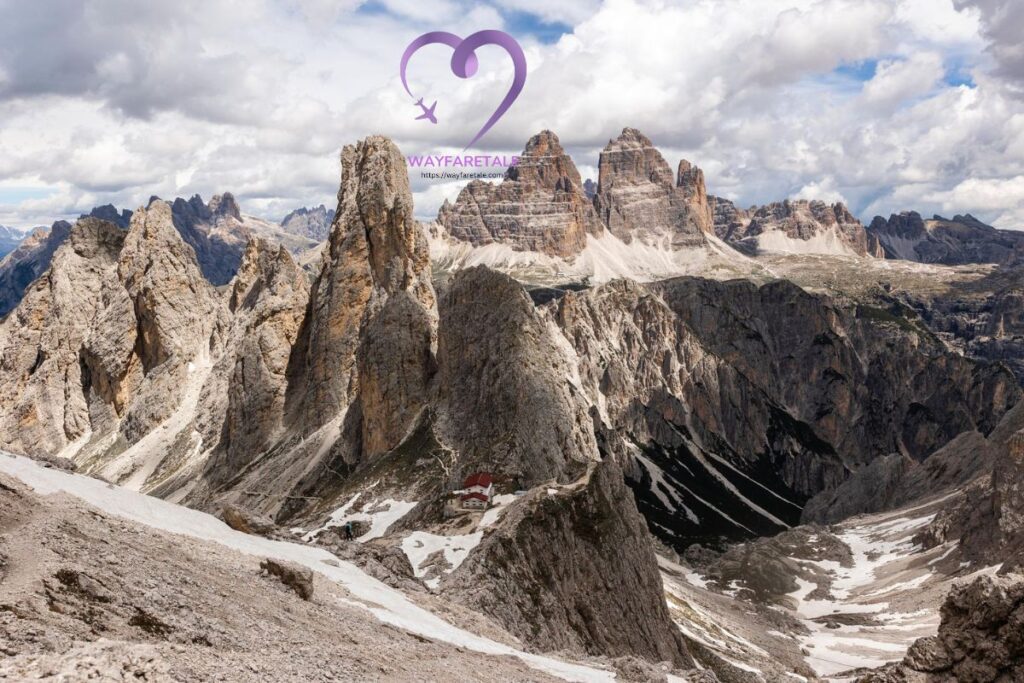
Suddenly, you find yourself entering Ciadin dei Tocci, a dramatic scree-filled basin surrounded by an amphitheatre of towering peaks. The moment you emerge into this basin is truly breathtaking.
To your left stands Torre Wundt, its vertical walls soaring into the sky. To your right is Torre del Diavolo (Devil’s Tower), living up to its intimidating name. Peering out from the ridge in front of you is your destination: Refugio Fratelli Fonda Savio at 2,367 meters.
The path curves around the left-hand side of the basin, following the natural contours of the landscape. This section is absolutely spectacular, with views changing with every step.
There’s a rougher section up a loose scree slope that requires careful footing. Take your time here and watch for loose rocks. The path zigzags a couple more times to gain height, but nothing is particularly technical or exposed.
Finally, the path traverses under the soaring pinnacles and ascends a short rocky gully to reach the rifugio. This final approach feels wonderfully wild and remote.
We seemed to have lots of energy on this hike and made it up in just over an hour. The rifugio appeared before us, wonderfully situated beneath the towering peaks, and we both enjoyed an excellent bowl of spaghetti Bolognese on the terrace while soaking in the incredible surroundings.
RIFUGIO VIEL DAL PAN TO REFUGIO FRATELLI FONDA SAVIO (1 hour 30 minutes)
From Rifugio Viel dal Pan, the trail becomes more challenging and the scenery even more spectacular. Pick up Path 601 again as it continues eastward.
The next section involves a descent into a rocky valley before climbing back up the other side. The path is well-marked but requires attention, especially if there are patches of snow lingering from winter.
After descending for about 15 minutes, you’ll cross a small stream (often dry by late summer) and begin the ascent toward the base of towering rock walls. This is where the hike really shows its alpine character.
The trail now climbs more steeply through a landscape of loose scree and massive boulders. Take your time through this section, placing your feet carefully on the rocky terrain. The path zigzags up the slope, making the gradient manageable despite the altitude.
About 45 minutes from Rifugio Viel dal Pan, you’ll reach a high plateau. The walking becomes easier here, though you’re now at considerable altitude. The air feels thinner, and you might find yourself breathing more heavily.
Continue following Path 601 as it traverses this high alpine zone. The landscape is stark and beautiful: grey rock, sparse vegetation, and the occasional patch of snow even in summer. Mountain marmots are common in this area, and you might hear their distinctive whistling calls.
The final approach to Refugio Fratelli Fonda Savio involves one more sustained climb. The refuge appears suddenly as you round a rocky outcrop, and the sight is breathtaking.
Refugio Fratelli Fonda Savio (2,367m) sits in a spectacular location beneath towering peaks, with views that seem to stretch forever across the Dolomites. The modern refuge offers excellent facilities and serves traditional mountain cuisine.
This is an exceptional place to stop for lunch. I arrived around 12:30 PM and enjoyed a hearty plate of canederli (bread dumplings) with a local beer, sitting on the sunny terrace and taking in the incredible panorama.
The refuge is named after the Fonda Savio brothers, local mountaineers who contributed significantly to alpine exploration in this region. Inside, you’ll find photographs and memorabilia documenting the history of mountaineering in the area.
After lunch and a well-earned rest, it’s time to retrace your steps back to Passo Pordoi. The return journey takes slightly less time as you’re mostly descending, but don’t rush. The afternoon light often creates stunning photographic opportunities, and the views are just as impressive walking in the opposite direction.
REFUGIOS ON THE ROUTE
One of the joys of hiking in the Dolomites is the tradition of mountain refuges. Here are the key rifugios you’ll encounter on this route.
REFUGIO FRATELLI FONDA SAVIO
This is your main destination, magnificently situated at 2,367 meters with commanding views of the surrounding peaks. The refuge offers a full menu of traditional Trentino and Tyrolean dishes.
Lunch is served from 12:00 PM to 2:30 PM, featuring hearty mountain fare including polenta, speck, cheese plates, and pasta dishes. The refuge opens from mid-June to late September and has overnight accommodation for 50 guests.
The terrace is the perfect spot to relax after your hike, with panoramic views that make it hard to leave. On clear days, you can see as far as the Marmolada glacier.
RIFUGIO VIEL DAL PAN
Located at 2,432 meters, this rifugio marks the midpoint of your journey. It’s a welcoming stop for refreshments and offers spectacular views across the Dolomites.
The refuge serves drinks, snacks, and light meals throughout the day. It’s particularly popular with via ferrata enthusiasts who use it as a base for climbing routes in the area.
Open from mid-June to mid-September, it’s an ideal place for a coffee break either on your way to or from Refugio Fratelli Fonda Savio.
PASSO PORDOI FACILITIES
At the end of your hike, you’ll find several restaurants and bars at Passo Pordoi. These are perfect for a celebratory drink while you rest your legs and reflect on the day’s adventure.
I recommend grabbing an Aperol Spritz and some chips while you stretch out on the terrace, watching other hikers return from their own mountain adventures.